I haven't got a lot of hobbies.
But one hobby is one of the most important in my life.
I am on a band. It calls Symbol of Denial.
Members:
Arch(me)
Evil Problematik
Moran
Rudolf
Frost
Nixso
and a drummer who has no nickname
We play rock and heavy metal like Bon Jovi, Iron Maiden and so on.
We haven'n had any concerts yet but we will play on the closing event at Domžale school in the end of the school year.
Well, this is my hobby...I play bas guitar in a band and I play it well, as my friends say.
See you later, Arch
Sunday, January 11, 2009

Monday, December 22, 2008
Merry Christmas!
Hello!
My students and I wanted to wish you a very merry christmas and we prepared you a little surprise! Please, don't mind my lack of technique and our lack of experience as pop star singers!
Merry Christmas!
Mrs. Cioc
My students and I wanted to wish you a very merry christmas and we prepared you a little surprise! Please, don't mind my lack of technique and our lack of experience as pop star singers!
Merry Christmas!
Mrs. Cioc
Tuesday, December 9, 2008
Pictures of Macedonia
Some pictures of Macedonia
Money

The Capital of Macedonia, Skopje

Flag of Macedonia

Map of Macedonia

Money

The Capital of Macedonia, Skopje

Flag of Macedonia

Map of Macedonia

Tuesday, December 2, 2008
Ex-Yogoslav republic MACEDONIA, my homecountry
| 1. surface of the country (land area in km2) | 25. 333 km
|
| 2. name of border countries and the sea |
|
| 3. number of inhabitants | 2.034.000 inhabitants
|
| 4. population density | 90 inhabitants/km2
|
| 5. number and names of regions | 3 regions: west middle part The Vardar valley, the eastern
|
| 6. altitude of the highest mountain |
|
| 7. name of the longest river | The |
| 8. name of the capital |
|
| 9. number of inhabitants in the capital | 590.120inhabitants
|
| 10. number of inhabitants in | 94.554 inhabitants
|
| 11. currency used in | Macedonian denary (MKD) |
| 12. Macedonian flag | Red&yellow with the coat of arms of |
| 13. road map of Macedonia | |
| 14. geographical map of Macedonia | |
| 15. your name and picture |
Elzana I.
|
Elzana, 1A class
Tuesday, November 25, 2008
Škofja Loka
ŠKOFJA LOKA
This is a presentation of the city Škofja Loka. This is a small town

Basic Information:
1. surface (land area in km2) : 145 km2
2. number of inhabitants : 21761 inhabitants
3. year of the first mentioning of the town - unknown
4. hills above Škofja Loka - Lubnik 1025m, Stari vrh 1217m, Koprivnik 1393m, Blegoš 1562m
5. name of the river that flows through Škofja Loka: The Sora
6. the cathedral: unfortunately we have no cathedral, see some pictures of our churches below
7. names of famous poets and novelists from Škofja Loka area: Ivan Tavčar (19th century), Tine Debeljak, Neža Maurer ...
8. number and type of museums: 2 history museums
9. number of cinemas; what's on this week? - one cinema, this week is on: James Bond: Quantum Of Solace
10. distance in km to the closest airport: 19km
10. number of swimming-pools: 2
11. picture of the cathedral (see below)
12. picture of some other sights (see below)
13. Submitted by Blaž Bernik 1.A, Aljaž Stanonik 1.A
History of the town:
The town's history began in 973 when Emperor Otto II granted the territory of Loka to Bishop Abraham of Freising in the Duchy of Bavaria. However Loka named in that deed of donation wasn't looking like now, but only a part of the town which is now known as Stara Loka (Old Loka).
In the Middle Ages the town of Loka was starting to spread around the confluence of the rivers Selška Sora and Poljanska Sora. The bishops of Freising renamed the centre of their lordship Škofja Loka and in a 1274 has received town privileges. In the early 14th century construction of a town wall began including five gates, each of them protected by a guard tower; most of it is still well preserved. The history shows that the town was many times faced by attack, fire and earthquake. The worst of the earthquakes in 1511 badly damaged the town which was later rebuilt by prince-bishop Philip of Freising. From that time on the image of Škofja Loka was just slightly changed so today it is now known as the best-preserved historic town in Slovenia. Old town core is consisted of the upper town square called Plac and the lower town square called Lontrg, both dominated by Škofja Loka Castle.
Some pictures of our town:

The town of Škofja Loka

St. Križ

St. Jurij (Stara Loka)

St. Andrej

The Sora River

The town square

Homan's house

The town's fountain
Information and pictures by Aljaž
Text editing and translating by Blaž
Thanks for your visit.
This is a presentation of the city Škofja Loka. This is a small town
on the sunny side of the Alps.
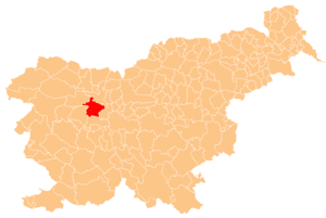
Basic Information:
1. surface (land area in km2) : 145 km2
2. number of inhabitants : 21761 inhabitants
3. year of the first mentioning of the town - unknown
4. hills above Škofja Loka - Lubnik 1025m, Stari vrh 1217m, Koprivnik 1393m, Blegoš 1562m
5. name of the river that flows through Škofja Loka: The Sora
6. the cathedral: unfortunately we have no cathedral, see some pictures of our churches below
7. names of famous poets and novelists from Škofja Loka area: Ivan Tavčar (19th century), Tine Debeljak, Neža Maurer ...
8. number and type of museums: 2 history museums
9. number of cinemas; what's on this week? - one cinema, this week is on: James Bond: Quantum Of Solace
10. distance in km to the closest airport: 19km
10. number of swimming-pools: 2
11. picture of the cathedral (see below)
12. picture of some other sights (see below)
13. Submitted by Blaž Bernik 1.A, Aljaž Stanonik 1.A
History of the town:
The town's history began in 973 when Emperor Otto II granted the territory of Loka to Bishop Abraham of Freising in the Duchy of Bavaria. However Loka named in that deed of donation wasn't looking like now, but only a part of the town which is now known as Stara Loka (Old Loka).
In the Middle Ages the town of Loka was starting to spread around the confluence of the rivers Selška Sora and Poljanska Sora. The bishops of Freising renamed the centre of their lordship Škofja Loka and in a 1274 has received town privileges. In the early 14th century construction of a town wall began including five gates, each of them protected by a guard tower; most of it is still well preserved. The history shows that the town was many times faced by attack, fire and earthquake. The worst of the earthquakes in 1511 badly damaged the town which was later rebuilt by prince-bishop Philip of Freising. From that time on the image of Škofja Loka was just slightly changed so today it is now known as the best-preserved historic town in Slovenia. Old town core is consisted of the upper town square called Plac and the lower town square called Lontrg, both dominated by Škofja Loka Castle.
Some pictures of our town:

The town of Škofja Loka

St. Križ

St. Jurij (Stara Loka)

St. Andrej

The Sora River

The town square

Homan's house

The town's fountain
Information and pictures by Aljaž
Text editing and translating by Blaž
Thanks for your visit.
Tuesday, November 4, 2008
SLOVENIA
SLOVENIA:
 the road map of Slovenia
 the road map of Slovenia
SLOVENIA:
| 1. surface of the country (land area in km2) | |
| 2. name of border countries and the sea | |
| 3. number of inhabitants | |
| 4. population density | |
| 5. number and names of regions | |
| 6. altitude of the highest mountain | |
| 7. name of the longest river | |
| 8. name of the capital | |
| 9. number of inhabitants in the capital | |
| 10. number of inhabitants in | |
| 11. currency used in | |
| 12. the Slovenian flag | |
| 13. the road map of Slovenia
| |
| 14. geographical map of | |
| 15. name of the the author |
Slovenia
SLOVENIA.
Slovenia is a small country in southern Central Europe. Her surface aims 20,273 km². Slovenia has 4 border countries:


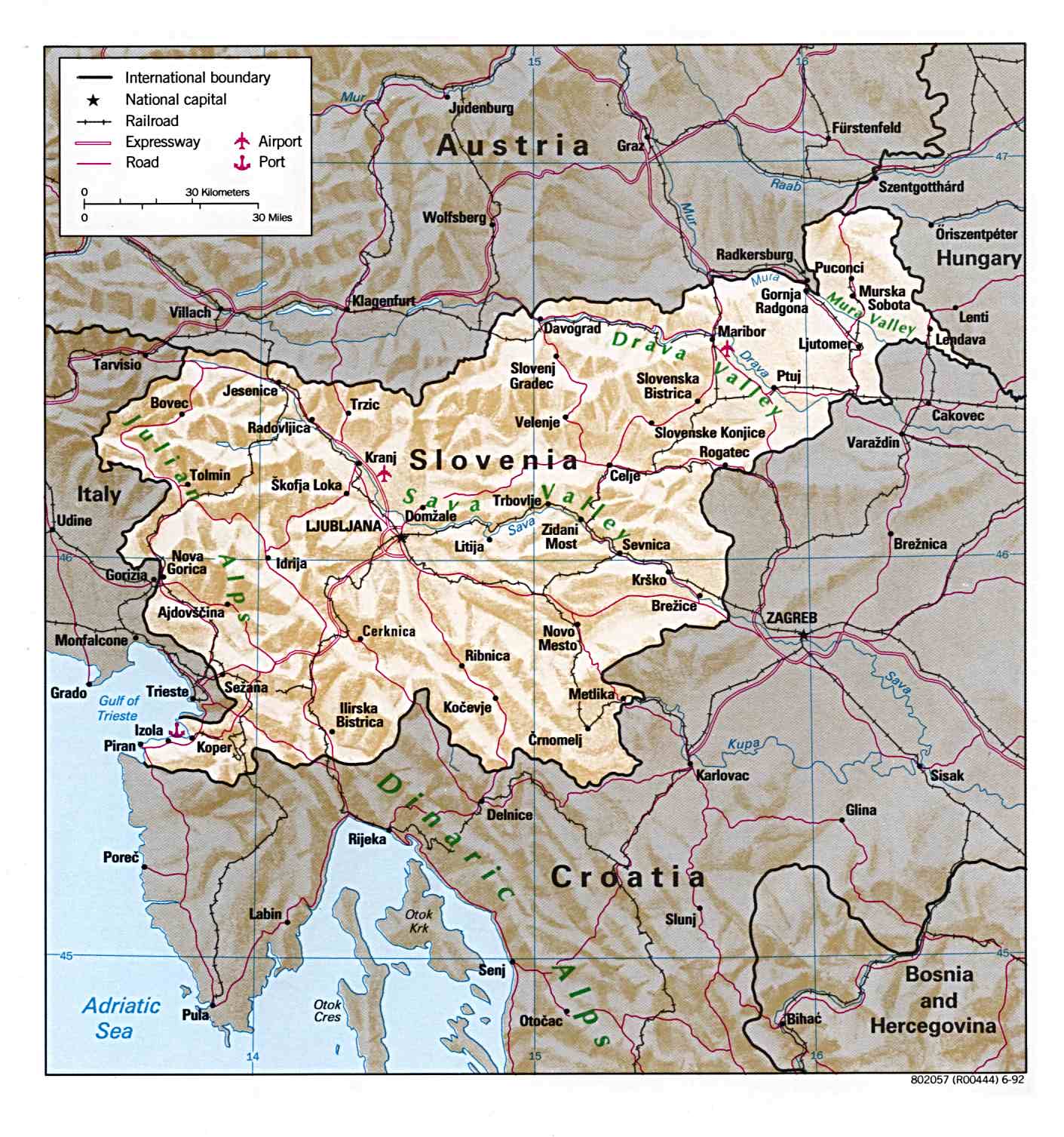
The Geographical map of Slovenia:

some other pictures of Slovenia:
Triglav

The Soča river

Ljubljana at Christmas time

Subscribe to:
Posts (Atom)